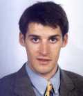
| Franck
SALGUES
12850 ONET LE CHATEAU - FRANCE |

Born on August 27th, 1975 in Rodez, FRANCE French nationality |
| General |
|
|
|
|
QUALIFICATIONS
1998-99 DESS of Computer
Sciences Applied to Earth Sciences (responsible : Professor
F. BOUILLÉ) in Paris University (post graduate diploma).
1995-98 IUP in Environment
and Geo-Engineering in Bordeaux University (graduate
diploma).
1993-95 DUT in Civil
Engineering in Toulouse University (undergraduate diploma).
1993 Baccalaureate C, specialising
in mathematics and physics in Rodez.
WORK EXPERIENCE
Present Technical-commercial engineer at SOMEI
- Praxitec (subsidiary of the SEM
-
Société des Eaux de Marseille) in the cartography activity
in Marseille, France. Development
of GIS softawre around GeoMedia,
in Visual BASIC. Installation of software among
customers, follow-up customer, formation with the software.
1999 Engineer at INTERGRAPH
France, in Civil Engineering - GiS - Networks division, at
Rungis (France).
Devlopment of a transcriber of GIS data under EDIGeO
format in
GeoMedia format, with Visual
Basic and Geomedia (4 months training period).
1998
Engineer at TOTAL Exploration Production, at the Subsurface Logging
Department, in
Paris-La Défense (headquarters). Research : application and limitation
of mudlogging
gas data in porosity prediction and fluid prediction (5
months training period).
1997
Technician at TOTAL Exploration Production, at the Subsurface Logging
Department
in Paris-La Défense (headquarters). Test of a logging tool database
management system
(3 months training period).
1995 Head of road
building site with S.A. FERRIÉ, in Onet-Le-Château (France).
Earthwork of roads, topography (2 months training period).
OTHER EXPERIENCE
1996 Technical agent
in the municipality of Rodez (France), employed at the festival
committee (one month's work).
1995 Technical agent
in the municipality of Rodez, employed as dust collector (one month's
work).
1994 Technical agent
in the municipality of Rodez, employed at green park's department (one
month's work).
Farmer experience in a family farm specialised in cow producing.
LANGUAGES
French : mother tongue.
English : good level.
Spanish : good knowledge.
SPORTS
Sportsman High Level :
Adventure Race (orienteering,
mountain-biking, canoe-kayak, climbing,
cross-country skiing, etc.) : Champion of France university 1998 and 1999
(team :
Aventure.com, France).
Football : vice-champion of French schools 1989.
HOBBIES
Linguistic : Occitan (regional language of the South of France).
Museum visits : Louvre museum, Orsay museum, British museum…
Cinema,
philately, history.
| Main
menu |
|
|
| COMPUTER SCIENCE |  |
PROGRAMMING LANGUAGES
C / C++ .
Pascal.
Basic.
Java (concepts).
ADA (concepts).
Fortran 90 (concepts).
Simula (concepts).
PROJECTS
Geomatics in Pascal : developemnt of a software of generalisation
of graphs of roads.
Structuring of a network in OO: transport, storage and distribution
of hydrocarbons.
Bibliographical study: PERT and AL. (structuring).
Software engineering in C and C++ with C++ Builder : execution of the
instructions of the
abstract types of data.
Remote sensing in C and C++ with C++ Builder: development of a software
of detection of a form
in a picture.
GIS
with Visual Basic : devlopment of a transcriber of GIS data under EDIGeO
format in
GeoMedia format(training period).
COMPUTERY
SUN Station.
Various PC.
Digitizer, tracer, scanner, engraver.
SYSTEMS
UNIX.
WINDOWS NT.
ETHERNET-TCP/UDP/IP, NFS.
| Main
menu |
|
|
| EARTH SCIENCE |  |
MODULES
Biostratigraphy, ecology, geo-biology.
Global and analytical Tectonics : types and processes of deformation,
seism, chains, margins and
basins.
Mineralogy, physics and chemistry of geo-materials : cristallochemistry,
optic crystals.
Magmatism, volcanism, plutonism. Descriptive petrology.
Metamorphism, geology of the bases. Descriptive petrology.
Geodynamics and petrology of sedimentary systems. Diagenesis. Descriptive
petrology.
Hydrology : hydro-climatology, hydraulic, chemistry of water, geothermalism,
hydrological systems.
Physics : physical properties of rocks, mechanics of the fluids,
mechanics of the continuous medium.
Geophysics : seismic, electrical methods, magnetism and electromagnetism.
Drilling, diagraphics.
Geochemistry : diagrams of phases, cristallogenesis, chemical bonds,
organic chemistry.
Cartography : geological map, photo-interpretation, spatial analysis.
OPTIONS
Petroleum : origins, traps and reservoirs, sedimentary and oil-bearings
provinces, exploration.
Geo-image and remote sensing : pattern recognition, image and microscopy
processing.
Geo-management : parameters of natural environment, environmental
impact, rehabilitation of
sites.
Natural and industrial risks : plans of exposure to the risks,
geological risks, underground
pollution.
FIELD INTERNSHIP
Sedimentology :
1997 Carbonate
Sedimentary environments of East Aquitan carbonate platform (France,
1 week).
1996 Geologic
and structural study of superior Miocene of low Languedoc (France,
1month).
Sedimentology study of limestone Oligocene of Gironde (France, 1
week).
Cartography :
1996 Geological cartography
of Permian-Triassic to Middle Jurassic of Brive region
(France, 3 weeks).
Cartography and tectonic analysis of Superior Carboniferous to Triassic
of Basques
Pyrenees (France and Spain, 1 week.).
Hydrogeology :
1997 Hydrology of the
environment of the water resources of the Cantal (France, 1 week.).
PROJECTS
Research project : hydrology in mountains.
Writing of administrative files and impact studies : overview of
an hydrogeological drilling.
OTHER COMPETENCES
Topography : more than 3 months practice.
Drilling : visit of a site of an underground storage of gas of GDF
(France). Installation and logging of
diagraphics.
| Main
menu |
|
|
| CIVIL ENGINEERING |
MODULES
Construction - Topography.
Organisation and conduct of works : bill of quantities, legislation.
Materials : concrete, organic materials and metallic materials.
Stability of the constructions : resistance of materials, wood,
metallic and concrete construction.
Reinforced concrete : calculations of reinforcements, laboratory
tests on structure of buildings.
Physics and technical equipment : electricity, climatic, acoustics.
Geotechnics : laboratory tests, dimensioning of foundation and retaining
works.
Design :
Building : drawing of architecture, foundation.
Structure : road infrastructure, retaining works.
Computer Aided Design : AutoCAD.
OPTION
Publics works and development :
Structure.
Road technologies.
Roadway systems and network various.
PROJECTS
Topography : statement of a building, and cartography.
Reinforced concrete : descent of loads, et dimensioning of foundation
slabs.
Final project : metallic construction, structural analysis.
OTHER
Topography : more than 3 months practice.
Building site : house, industrial buildings, bridges, highways,
adjustment of allotments.
